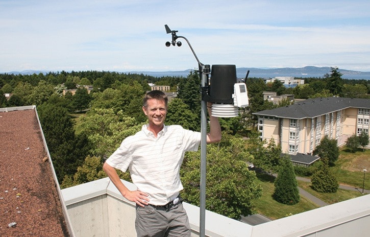
The sun forces Ed Wiebe to squint as he swings open a heavy door and steps into broad daylight on the roof of the Bob Wright Centre of Ocean, Earth and Atmospheric Sciences at the University of Victoria.
When he opens his eyes, he makes his way through a grid of student astronomy telescopes to a weather monitor a few meters away.
The little black spoons of the anemometer are constantly spinning as they measure the wind and add another piece of weather data to the School-based Weather Station Network, comprised of about 150 stations at schools across Vancouver Island.
“We received some grant funding and put these stations around the South Island in partnership with the school districts. Right away we learned there is a great discrepancy in weather conditions across Greater Victoria,” says Wiebe, who started the project in 2002 with Andrew Weaver, now Oak Bay-Gordon Head MLA.
The stations record and report the temperature, humidity, wind speed and direction, air pressure, rainfall, sunshine (solar power), amount of sun energy coming in, UV index and rain rate. It’s all collected in a server at UVic and made available (with a four minute delay) on the website and app.
Even more handy is the smartphone app, which reports the weather from every station on the Island within the last five minutes.
“The first station we ever installed is actually on the Ian Stewart Complex as we used to be in an office there,” Wiebe says.
The network has since grown substantially but remains a part time job for Wiebe, a research associate in UVic’s renowned Climate Modelling Group Lab, lead by Weaver.
“We were fascinated by what the station was showing. We wondered if we could install more but have them in a closer distance than the local Environment Canada stations,” Wiebe said.
Environment Canada provides a fairly accurate weather picture with a few stations in Greater Victoria. But Environment Canada’s station at the airport, which is often referenced, is quite a distance from Victoria and Saanich, and its results are delayed in comparison to the School-Based Network.
For example, it’s often two to three degrees warmer in the Highlands than the coastal zones of James Bay and Fairfield. It also rains approximately 50 per cent more at the airport than downtown Victoria.
“With the stations so close together we could you see interesting weather differences, especially cold fronts moving across the Island, which we pick up quite accurately,” he says.
The majority of the stations are on built on elementary and middle schools, with some high schools too.
It’s part of the project’s mandate to educate and engage students with science, when resources are available. Each station comes with a display monitor that teachers and students use to follow along.
“We’ve provided educational resources on site for teachers and there are established lesson plans for teaching weather,” Wiebe says.
“We’ve also found teachers are using it in different ways. Some schools chart the data each day on the wall in the hallway, and some have students announce the daily weather report on the PA.”
Last month Wiebe spent a few weeks installing nine more in Campbell River, Sayward and Cortes Island.
Here in Greater Victoria there are stations coming and going.
Quadra elementary will be back online following its seismic restoration, George Jay elementary has gone offline ahead of construction.
reporter@saanichnews.com