A new geography course at the University of Victoria is testing students’ kite-flying skills to monitor the state of beaches across Greater Victoria.
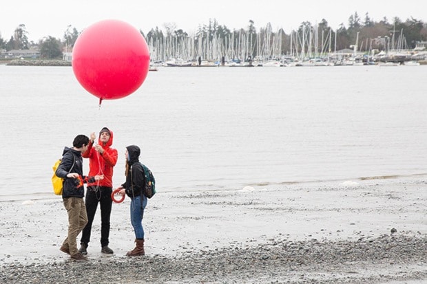
Fourth-year undergraduate students from UVic’s Advanced Studies in Geomorphology – the study of the earth’s physical features and their relation to its geological structures – started a new project this week, using kites and balloons with cameras to survey the beach at Cadboro Bay on a rainy Monday afternoon.
Co-developed by instructor and PhD candidate Michael Grilliot and geography professor Ian Walker, the course combines low-altitude aerial photography with Lidar – a form of radar that uses lasers to measure distance – to construct virtual, 3D maps of coastal systems.
“The Lidar creates 3D surfaces from a bunch of points and with the cameras, we can use the overlap from those photos to create a 3D structure,” said Grilliot.
Over the next three months, students will conduct group projects, monitoring the state of beaches all over Vancouver Island using techniques learned from the course.
“The groups are all focusing on different areas,” said Grilliot. “One of the groups is focusing on the Dallas Road bluffs, so they’re looking at historical aerial photography to determine where the shoreline is and where it’s been. They’re going to collect their own data and see if they can use these technologies to detect change and erosion on the beach.”
According to Grilliot, the course gives students hands-on experience working with these technologies, allowing them to develop valuable skills that they can carry into the workforce.
“Our goal is to provide the students with the ability to use these technologies,” he said. “That way they can take that knowledge with them to either grad school or consulting agencies or government agencies, and that will give them a foot in the door.”
Grilliot said the long-term plan for the course is for future students to continue monitoring the state of local beaches after former students graduate, eventually building up many years of valuable geographical data that can be shared with local municipalities and other groups.
“We’re just giving students a great opportunity to use these technologies, even in the rain,” said Grilliot. “We’re geography students, so we can handle it.”